Anglo-Saxon Romsey and the Lower Test Valley

This site is still under development, more material will be added over the coming weeks. If you are interested, please check back regularly.
The Saxon Project
Romsey is a small town in the centre of the lower Test valley. Romsey Abbey is the largest parish church in Hampshire. This is a legacy from the nunnery founded in the 10th century which dominated the town until the Reformation in the 16th century, when Henry VIII closed it. Despite this the amount known about Romsey and the lower Test valley in Saxon times is very limited. In 2014 Romsey Local History Society (also known as Lower Test Valley Archaeological Study Group) decided to mount a project to assemble and analyse all the information known.
In 2013 Christopher Collier, one of our long term members, died and left the society a substantial bequest. In view of his interest in Romsey in Saxon times it was decided to use this bequest to instigate a major project on a study of the lower Test valley in the Saxon period. The project was co-ordinated by the then chairman of the society, Phoebe Merrick. Through the generosity of Christopher Collier the society was able to obtain advice, support, and training from the University of Winchester particularly from Professor Ryan Lavelle, Dr Alex Langlands, Dr David Ashby and Nathalie Barrett. From 2015-2019 the group looked at the whole area in and around the lower Test valley, from Mottisfont to Millbrook and Chilworth to Tytherley.


Professor Ryan Lavelle
Photo by Karen Anderson

Bequest funds were also invested in training members of the society in the use of GIS mapping as well as geophysical surveying which will have long term use for other projects. Colin Moretti took over the management and development of the QGIS system, georeferencing numerous tithe and estate maps which have proved invaluable in analysing and understanding the landscape. A number of expeditions/outings were organised to look at the landscape and test out our theories and interpretations.
Examining the boundary landmarks of the Ampfield charter with Alex Langlands.
Photo by Karen Anderson

Using QGIS

Looking for the source of iron ore.
Fortnightly discussion meetings were held in addition to walks to explore the study area. Much use was made of the resources of the Hampshire Record Office and The National Archives at Kew.

Finding burnt flint
Photos by Mary Harris

Studying the site of old Timsbury Bridge


Anglo-Saxons and River Valley Settlement conference, held 2016
Photos by Karen Anderson
Click here for summaries of the lectures.
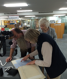


Examining and photographing documents at The National Archives, Kew.
Anglo-Saxon Project exhibition in Romsey Town Hall.
Photos by Karen Anderson
The major studies undertaken were:
-
A review of what is known of each parish in the Saxon period.
-
Collection, creation and analysis using QGIS of all the pre 20th century maps available.
-
A consideration of the geology, landscape, and the watercourses, natural and artificial, in the lower Test valley.
-
A review of the evidence for the history of Romsey Abbey in the Saxon period, archaeological and literary, this included funding a GPR survey within the Abbey church.
-
A study of all the local Saxon charters, giving descriptions of their boundaries.
-
A review of the archaeological evidence for the Saxon period in the Test valley, including particularly the iron smelting in the Narrow Lane area of Romsey and the Saxon pottery kilns at Michelmersh.
-
A review of the literary evidence for the development of Christianity and the Church in the lower Test valley, particularly concerning Nursling.
-
A review of all the evidence given in Domesday Book for the lower Test valley - this is planned to be published as a book.
Page completed December 2022